
Elevation and LiDAR
Long profiles, contour lines and LiDAR point clouds extracted per parcel, straight from national datasets.
Explore this toolLoading
Online topographic survey · 8 countries covered
Locate a parcel, analyse its terrain and produce technical deliverables before the first site visit. GeoAlt brings together land registry, elevation, LiDAR and planning data.
Real deliverables produced by GeoAlt
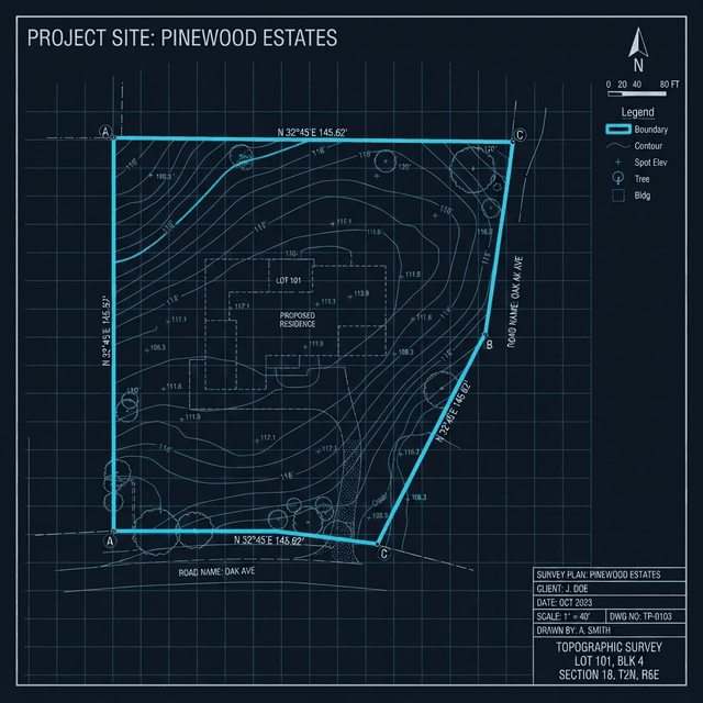
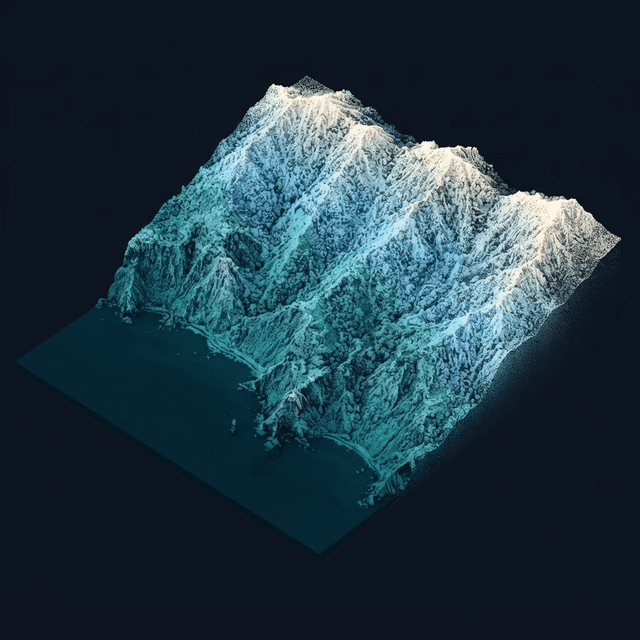
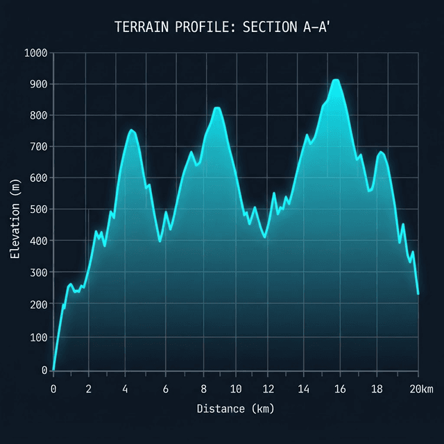
Interactive demo
Pick an iconic place: the point cloud laser-measured by IGN appears instantly. Switch between land-cover classification and satellite orthophoto, orbit, zoom in — every point is a field measurement, not a rendered image.
Reference public datasets brought together in one workflow, from parcel to deliverable.
Coverage
Each country queries its own official sources — land registry, elevation, LiDAR. Data families that are not open are hidden, never approximated. Everywhere: elevation profiles, measurements, drawing and exports.
| Country | Land registry | LiDAR cloud | Planning & risks |
|---|---|---|---|
| France (incl. Corsica) | Available | LiDAR HD | Available |
| Belgium | Flanders | DHMV II | Risks |
| Netherlands | Available | AHN 5 | Available |
| Luxembourg | Available | ATLiDAR | Risks |
| Switzerland | Available | swissSURFACE3D | — |
| Spain | — | PNOA | — |
| Austria | — | Salzburg (Land) | Risks |
| United Kingdom | — | — | — |
Coming soon : United States (3DEP, feasibility verified), Germany (open LiDAR from several Länder) and Ireland — same method, same deliverables.
One workspace, four disciplines
Each module starts from your boundary and keeps its cadastral context to produce a directly usable result.
Long profiles, contour lines and LiDAR point clouds extracted per parcel, straight from national datasets.
Explore this toolParcels, local planning zoning, easements and protected perimeters — all queried in one place.
Explore this toolReference platform, cut and fill computed over the boundary you draw, with a volume summary.
Explore this toolDistance to shoreline, listed sites and coastal constraints, detected automatically.
Explore this toolBuilt for early decisions
Each discipline gets the useful context without rebuilding it from scattered sources.
Qualify a site before concept design.
Feasibility, parcel context, site plan and BIM terrain.
Study a parcelEstimate the impact of terrain early.
Slopes, profiles, contours, platforms and earthworks volumes.
Study a parcelPrepare fieldwork and the drawing base.
LiDAR pre-study, points, sections and CAD exports — without replacing a regulated survey.
Study a parcelCross-check land potential and constraints.
Parcels, zoning, easements, risks and multi-scale analysis.
Study a parcelFiles, not just data
Choose a parcel or boundary. GeoAlt assembles the context, computes the terrain and delivers the right level of detail for your workflow.
One document with cadastral identity, feasibility, planning, risks, site plan, sections and available LiDAR buildings.
Contours, profiles, spot heights, slopes and earthworks volumes to start the study.
Classified points, surface model and mesh from national LiDAR tiles.
Parcel, terrain and detected existing buildings when available, ready to join the project model.
An open workflow
GeoAlt deliverables are prepared for leading CAD, BIM, design and GIS tools. The recommended format and any conversion steps depend on the software, version and installed modules.
 AutoCAD
 Autodesk Revit
 Archicad
 ZWCAD
 Chief Architect
 ALLPLAN
 FreeCAD
 Cedreo
 SketchUp
 QGIS
Export formats
Free account
Browsing is free and stays free: create your account, receive 35 welcome credits and explore the workspace without a credit card.
No credit card — browsing stays free forever.
Straightforward pricing
Choose monthly billing, or save two months and receive 20% more credits with annual billing.
Save two months and receive 20% more credits with annual billing!
Your trade
Free
35 welcome credits offered
Browsing is free forever — pay only for deliverables.
15€excl. VAT / month
45 credits included
Ideal for tradespeople (equivalent to 2 surveys)
30€excl. VAT / month
105 credits included
For small practices (equivalent to 5 surveys)
50€excl. VAT / month
210 credits included
For high-volume teams (equivalent to 10 surveys)
From 2 credits per euro for occasional needs. Purchased credits never expire.
Get 40 credits
€20 excl. VAT
Get 105 credits
€50 excl. VAT
Get 220 credits
€100 excl. VAT
Questions before you start
The map, land registry, parcel information and feasibility checks use no credits. The first AI-written synthesis is on the house, no card required. Only producing a LiDAR or elevation survey uses credits according to area; all its files and PDFs are then included.
GeoAlt queries the national public datasets of each covered country: IGN and the French planning portal in France, AHN in the Netherlands, swissSURFACE3D in Switzerland, PNOA in Spain… LiDAR depends on published tiles; a national raster DTM takes over where that coverage is unavailable.
No. GeoAlt prepares a study and supports decisions. Its documents are neither a legal boundary survey, nor a regulated survey, permit or planning certificate.
Depending on the deliverable: PDF, 3D DXF, CSV/XYZ, E57, IFC, OBJ, STL and SVG. They cover CAD, BIM, point-cloud, modelling and 3D-printing workflows.
They are traced when LiDAR returns classified as buildings are available and dense enough. A missing building in the document therefore does not prove that no structure exists on site.
Browsing remains free. Producing the survey uses credits based on area; once paid, its PDF, DXF, E57, CSV/XYZ, IFC, OBJ, STL and SVG formats can be downloaded as often as needed at no extra charge. Plans grant credits monthly and purchased top-ups do not expire.
Land registry, elevation and planning: the national public datasets of the country being viewed (IGN in France, AHN in the Netherlands, swisstopo in Switzerland…). The documents produced are decision-support aids: they replace neither a chartered surveyor’s report nor an official planning document.
Open the map, search for your site and browse the first information for free.
Start on a parcelDirect conversation
A question about your parcels, deliverables or integrating GeoAlt into your workflow? Pick a slot: phone or video call, no commitment.
Open the calendar in a new window